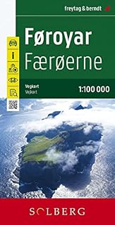
Färöer - Føroyar, Straßenkarte 1:100.000, freytag & berndt: Wegenkaart Schaal 1 : 100.000: AK 6302 by Amazonundefined
Description
Die
Straßenkarte Färöer - Føroyar
im Maßstab 1:100.000 enthält zahlreiche nützliche Informationen für eine Reise auf die nördliche Inselgruppe. Das Straßennetz ist natürlich sehr detailliert abgebildet und viele besonders sehenswerte Ausflugsziele sind in der Karte eingezeichnet. Auto-, Motorrad-, und auch Radfahrer schätzen die exakte Kartographie von freytag & berndt besonders für die Planung Ihrer Touren und die Orientierung vor Ort. Sehenswerte Ausflugsziele sind mehrsprachig beschrieben.
Informationen zur Straßenkarte Färöer - Føroyar
Maßstab 1:100.000
Campingplätze
Wanderwege und Höhenlinien
Vogelbrutplätze
Fähren
Cityplan Tórshavn (dänisch Thorshavn)
Ortsregister
Format: 84 x 121 cm
Opis z tylnej okładki książki
freytag & berndt maps are available for many countries and regions in the world. In addition to the precise cartography each map also includes a lot of additional information about the region covered.
Product information
- Język:Angielski
- Wydawca:Freytag-Berndt und ARTARIA
- Data publikacji:1 stycznia 2018
- Wymiary:13 x 0.8 x 25.5 cm
- ISBN-10:3707915123
- ISBN-13:978-3707915129
- Author:freytag & berndt
Related products to Färöer - Føroyar, Straßenkarte 1:100.000, freytag & berndt: Wegenkaart Schaal 1 : 100.000: AK 6302:

Explore other categories
Other products from Strzelectwo, myślistwo, wędkarstwo: